Hike, bike Canfield’s east side
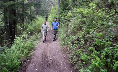

The east approach to the Canfield Mountain Trail System offers another perspective to this great recreational area in the mountains backing Coeur d’Alene. More frequently accessed from the west side off Nettleton Gulch Road, the U.S. Forest Service-managed wilderness playground incorporates more than 25 miles of forest roads and paths open to motorcycles, mountain bikes and hikers. Just off Fernan Lake Road, Trail No. 10 trail begins along a peaceful creek through a dense forest of cedar and pines and then climbs along ridges to Stacel Saddle, overlooking Hayden Lake.
Access from I-90: Take exit No. 15 (Sherman Avenue), then head north on Sherman past the Fernan ranger station. Bear left at the “Y” intersection to Fernan Road (County Road 108, which becomes Forest Road 268) for 5.5 miles to the shooting range parking lot on the left side of the road.
Length: 2.9 miles (one way).
Elevation: There is an elevation increase of approximately 1,420 feet from the parking lot to the trail end.
Use: Moderate.
Trail condition: Varies from hard-packed footpaths to narrow trails with loose dirt and rocks. Some trails contain ruts, roots, obstacles and steep drop-offs along edges. Creeks run high during periods of rain and may require crossing.
Difficulty: Moderate to mild with a particularly steep stretch between the A and B trails.
Restrictions: The use of three- and four-wheel all-terrain vehicles and Jeeps is prohibited.
What to see: Wildlife, forests and views of Hayden Lake, mountains and valleys.
Special features: Well-marked trails and signage – numbered trails generally run north to south and usually have the steepest climbs. Letters mark east-to-west trails. There are several unimproved campsites. For a side trip, take the short but very steep trail east from the parking lot. This “Cardiac Hill” offers great views, and a Geocache is hidden on the trail.
Preparation: A free trail guide is available at the Coeur d’Alene River Ranger District, Fernan Office, 2502 East Sherman Ave., in Coeur d’Alene; (208-664-2318, www.fs.fed.us/outernet/ipnf) or from the U.S. Forest Service, 3815 Schreiber Way in Coeur d’Alene. The Forest Service suggests leaving your trip schedule with a responsible person.
Gear: Good walking shoes or hiking boots are essential. Dressing for changing conditions and carrying drinking water and a first aid kit are always good ideas.
Note: From the parking lot, pass through the cement barricades to access the trail. The Forest Service advises trail courtesy to include bicycles yielding to all other trail users and hikers yielding to motorcycles. Motorcyclists should slow down when approaching other trail users. Geocaches are found in a treasure hunt game using clues from the Web site, www.geocaching.com.