Pend Oreille River overflows its banks
The Pend Oreille River was flowing at its highest level in 14 years on Tuesday, creating a watery landscape in the river valley northwest of Newport, Wash.
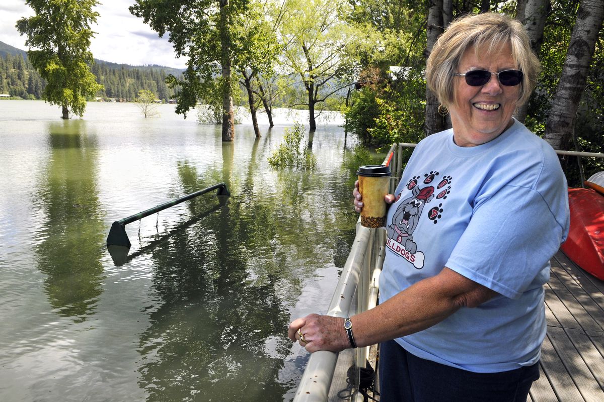
Minor flooding was prevalent, so Cj Lockhart of Spokane drove north to check on her daughter’s home along the river between Newport and Usk.
“I wasn’t really worried,” Lockhart said. “I was more curious than anything.”
Trees and beaches were swamped. Water had risen to the top of a swing set outside the house. A fire pit was submerged under several feet of water. The nearby pasture was flooded to the fence line.
But the home was safe on a rise above the swollen waterway.
“It’s very dramatic,” Lockhart said. “I’m glad the kids are as high and dry as they are.”
The river was measured at Albeni Falls Dam east of Newport at 117,600 cubic feet per second Tuesday and near its crest, according to the Advanced Hydrologic Prediction Service of the National Weather Service.
The flooding was attributed to a combination of spring rain and an above-average snowpack.
Forecasters said flooding across the region could have been worse, but the cooler-than-normal weather in recent weeks has slowed the snowmelt at higher elevations.
Upstream, Lake Pend Oreille reached flood stage over the weekend and continued to slowly rise. It was at an elevation of 2,064 feet Tuesday, just a half foot above flood stage.
Katherine Rowden, of the weather service in Spokane, said Monday that the lake and river system would remain full and at flood stage because of the large amount of snow still clinging to the high mountains of the region.
The lake may drop below flood stage early next week, but the river below Albeni Falls Dam is likely to remain above flood stage of 100,000 cubic feet per second for some time.
But the river and lake are not expected to rise from current levels.
At 100,000 cfs, water begins creeping toward several homes and floods yards, outbuildings, sections of roads and recreation sites northwest of Newport.
More serious flooding occurred June 5-7, 1997, when the river flow reached 138,200 cfs, getting into homes and covering grounds and roads.
The weather service said that a flow of 130,000 cfs would flood many homes in the Riverbend, Sandy Shores and Sunvale Acres developments.
Pend Oreille County’s no-wake ordinance took effect when the river went to 85,000 cfs last month.
Don Banning, who has lived along Davis Creek just upstream from the river, remembered 1997 well.
“It was up past the pump house,” he said, pointing to a small building below his home. This year’s flooding is no big deal, he said.
During high water, the river backs up and covers the creek, creating a small lake around Banning’s property.
On Tuesday, a footbridge over the creek had disappeared beneath the water.
A pair of fishermen took advantage of the flood and motored up the creek channel in search of bass and pike. They said they’d caught several by flipping lures.
Elsewhere in the region, the Kootenai River at Bonners Ferry appeared to have crested by Tuesday and was expected to drop. It reached 63.27 feet on the Bonners Ferry gauge, just below the flood stage of 64 feet.
The river should slowly recede for the rest of this week, forecasters said.
Moderate flooding was reported on the Okanogan River at Tonasket on Tuesday, where the river has been falling since Saturday morning.
The Moyie River at Eastport was less than a foot below flood stage and expected to remain there through the week.
The Similkameen River in central Washington was also less than a foot below flood stage.
The St. Joe River at St. Maries was more than inch below flood stage after having been over flood stage since mid-May.