Arrow-right Camera
The Spokesman-Review Newspaper
Spokane, Washington  Est. May 19, 1883

Getting There

More bike lanes are coming to downtown Spokane (with illustrations!)

A cycling family leaving Kendall Yards waits on traffic before crossing the north end of the Monroe Street Bridge at Summit Parkway on Thursday. (Dan Pelle)

This year will see the completion of Spokane's Downtown Bike Network, a loop and spurs of bikeways for the city's core. For the past few years, downtown cyclists have been able to ride on a few bike lanes and shared roadways (and the infamous "sharrows"), but by fall the whole shebang will be complete.

Less than a month ago, some city staffers presented the second phase of the network to small crowd at the Community Building on Main Avenue. This is what they saw.

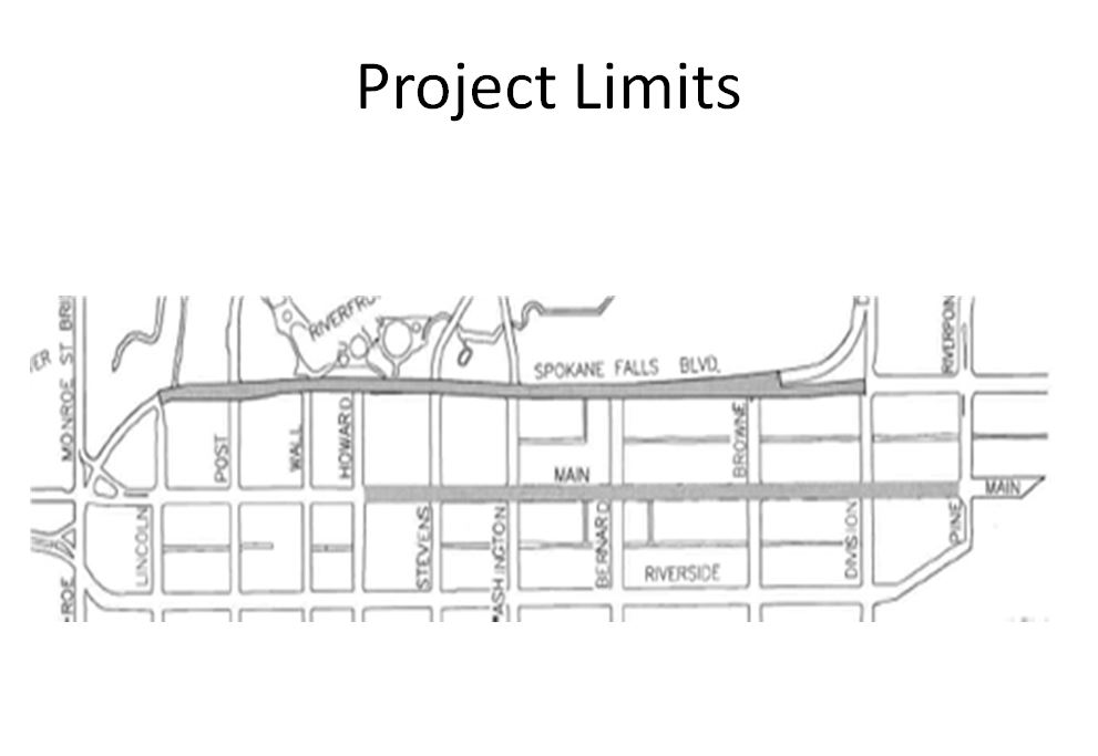
We'll start first with a general map of the downtown showing where new bike lanes will be added.

Where bike lanes will be added to Downtown Bike Network in 2015. Courtesy City of Spokane

 This next map shows how car lanes will change this year.

Car traffic lane changes, coming in 2015. Courtesy City of Spokane

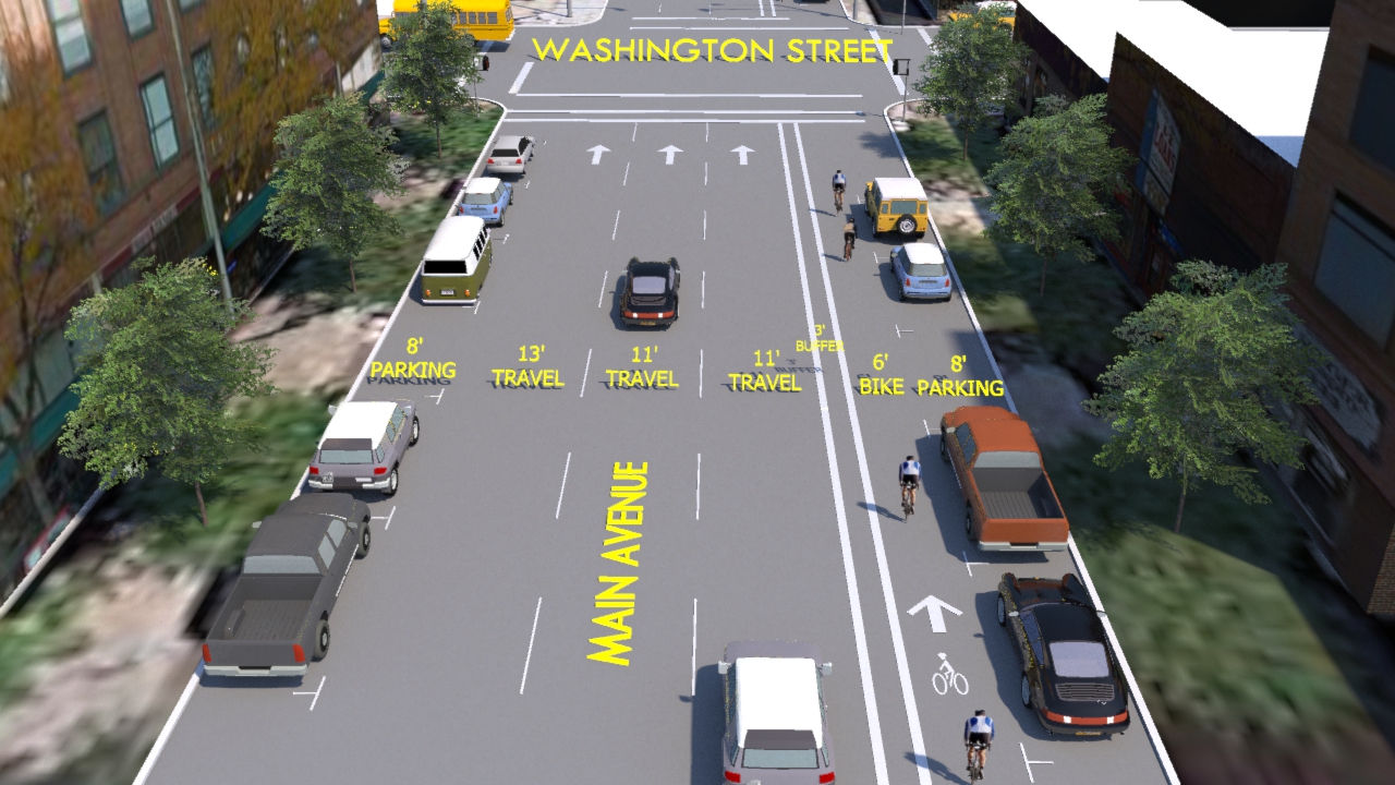
Now, here are some renderings of what the intersections will look like. This first illustration shows the intersection of Main and Washington. Auntie's Bookstore is on the left, and we're facing east.

Rendering of Main and Washington with a buffered bike lane. Courtesy City of Spokane

Further east, this one shows the intersection of Main and Division. For orientation, the University District is straight ahead, and Zola's would be on the left.

Rendering of proposed bike lane at Washington and Division. Courtesy of City of Spokane

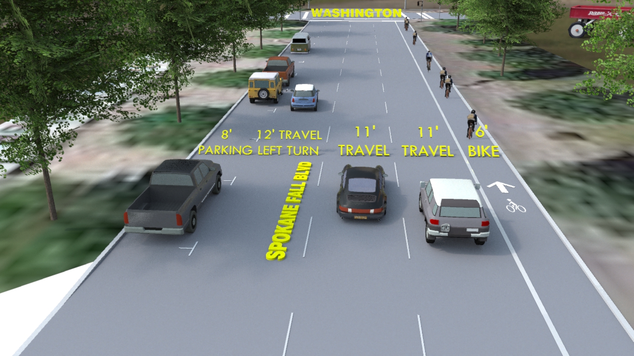
Now, we'll head down Spokane Falls Boulevard, heading west. This illustration shows Spokane Falls and Washington. Notice the world's largest little red wagon on the right.

Illustration of proposed bike lane at Spokane Falls Boulevard and Washington. Courtesy City of Spokane

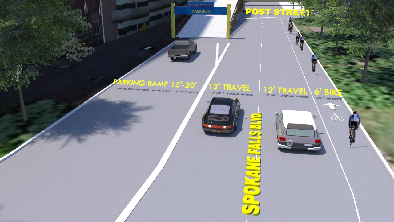
Finally, here we are at Spokane Falls and Post, which is the street made of brick downtown. At the end of the block, the bike lane will peter out and cyclists will have to join vehicular traffic to continue. This loss of lane caused some consternation at the open house last month, as some older riders said they could not keep up with traffic and would be forced to ride on the sidewalk, which is illegal downtown.

Illustration of proposed bike lane at Spokane Falls Boulevard and Post Street. Courtesy of City of Spokane

It will cost $224,000 to complete the Downtown Bike Network. It is being paid for with funds from the federal Congestion Management and Air Quality program.


Nicholas Deshais
Joined The Spokesman-Review in 2013. He is the urban issues reporter, covering transportation, housing, development and other issues affecting the city. He also writes the Getting There transportation column and The Dirt, a roundup of construction projects, new businesses and expansions. He previously covered Spokane City Hall.

Follow Nicholas online: