Services make it easy to map out adventures

In preparation for a trip to Utah last month, I went purposefully overboard on the procurement of maps. To scout new wilderness I’ll often purchase a few United States Geological Survey (USGS) quad maps and maybe buy a guidebook or two. But for my Utah trip I needed more.
Indeed, my goal — to scour a large chunk of eastern Utah in preparation for the Primal Quest adventure race — was a project that would call into service several cartographic companies and at least two U.S. Government agencies.
BLM: I went online to get contact information for the Bureau of Land Management’s Utah office. The BLM ( www.blm.gov) is a U.S. Department of the Interior agency that oversees 261 million acres of public lands, including a good share of the land in eastern Utah.
Map offerings from the BLM vary from topographicals that cover hundreds of square miles on down to specialized recreational maps that focus on a single trail. One map, titled “Utah’s Colorado Riverway Recreation Guide,” for example, is essentially a brochure on boating a stretch of the Colorado River near Arches National Park. The bureau’s map of Moab, in contrast, is a 1:100,000 scale look at a 50-mile-wide area.
Most BLM maps are free at regional offices. I called the main Salt Lake office and the agency mailed a packet of maps and brochures.
Forest Service: The U.S. Forest Service ( www.fs.fed.us) was another great source for free or low-cost cartographic information. Like the BLM, the Forest Service’s offerings included large-scale overviews as well as close-ups. Huge National Forests like the Manti-La Sal are put on paper in the oddball 1:126,720 scale, which provides sparse detail. Another map, “Arapeen OHV Trail System,” is a detailed brochure and trail map where a mile measures about 2 inches on the page.
One caveat with the government-supplied maps: Many are outdated. Some of the maps I received from the Forest Service, for example, were last revised more than 10 years ago. USGS quads are often outmoded, too, with information garnered in the 1970s or even earlier. Land formations, rivers, lakes and major roads should be correct and literal on these older maps, but trails, county roads, property boundaries, city streets, and other features may be inaccurate or absent altogether.
Trails Illustrated: On the private-sector side, National Geographic’s Trails Illustrated maps were handy. These full-color maps are printed on waterproof paper and include several scale representations of an area as well as three-dimensional views, all on a single large sheet that folds down to the size of a state highway map.
The Trails Illustrated maps ( www.ngmapstore.com), which cost $10 each, cover national parks, recreational areas, islands, coastlines, and mountain ranges. BLM and U.S. Forest Service land, with updates on roads and trails, are included in the series as well.
Trails.com, an online repository of map data and downloadable guidebooks, is good if you have a specific activity in mind. Say you want to bike Moab’s famous Slickrock Trail. Just type in “slickrock trail” in the site’s search engine and a downloadable guide will pop right up, available for purchase as an Adobe PDF file that you print out at home.
Free trial memberships are available on Trails.com. A yearly subscription that includes 50 trail downloads and unlimited access to the site’s topo maps costs $50.
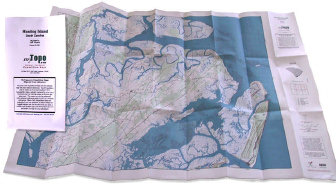
Mytopo.com has a searchable online database of USGS topographic maps and satellite photos. This slick site lets you search, scroll, zoom in and create custom maps in just a minute or two. The company then prints the map on waterproof paper and ships it out within two days. Prices range from $10 to $30 per map, depending on size and paper type.