Walkers’ window
Spring break is over and Memorial Day weekend is down the road. While the next six weeks are busy for many families, this is boogie time for hikers who’d sooner chance the odds of iffy weather than face the certainty of summer crowds. Snow still blocks access to most backcountry destinations in the mountains, but lakeshore trails, such as those at Sullivan, Priest and Chelan, are opening for walkers who want to be there when the buds begin to burst open.
Driving west or south from Spokane can put you into sunnier weather and temperatures several degrees warmer.
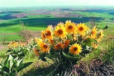
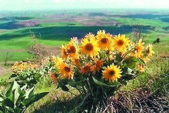
Desert-like areas in the Columbia Basin and Hells Canyon, for example, are about to explode with blooming balsamroot and other showy flowers.
By summer, when most families have the time, these areas are hot, brown and uninviting. Cheatgrass spears get in your socks. Mosquitoes get under your skin.
Ticks are the most notable vermin this time of year. While hiking, take defensive measures such as wearing long-sleeve shirts and pants. tucking shirt tails in pants and pant legs in socks. Wear light clothing, which makes it easier to spot ticks as they cruise your body looking for an opening to bare skin. Check yourself and your partners often.
Use sunscreen liberally on winter-white skin.
Enjoy the walk.
Following are some of the best bets for early-season trails:
Local day hikes
Dishman Hills Natural Area: Trails loop through more than 500 acres of pine forest, ravines, ponds and overlooks in this Spokane Valley gem. First-timers should start at the Camp Caro trailhead at the south end of the Hills off Sargent Road.
Info: Spokane County Parks, (509) 477-4730.
Riverside State Park: Few people have discovered all of the 55 miles of trails in this park along the Spokane River. A trail map is sold at outdoor stores and Northwest Map and Travel Book Center. For introductions, start from the suspension bridge at the Bowl and Pitcher, where the river roars under your feet. Or begin from the Centennial Trail parking lot near Nine Mile Dam and branch out onto the dirt trails and Deep Creek Canyon south of the river.
Info: (509) 456-3964.
Tubbs Hill in Coeur d’Alene is circumnavigated by a gem of a trail with two-thirds of the three-mile route overlooking Lake Coeur d’Alene. The trail provides access to a few beaches. Access is from the city boat launch parking area just east of the Coeur d’Alene Resort or at a parking area near 10th Street and Mountain Avenue.
Info: None needed.
Q’emiln Riverside Park: Pronounced Kih-MEE-lin, this Post Falls park has more than three miles of trails rambling along basalt rock cliffs popular with climbers and through native vegetation along the Spokane River. From Interstate 90 at Post Falls, take Exit No. 5 and head south on Spokane Street, across the Spokane River and right on Parkway to the trailhead at the end of the road.
Info: None needed.
Road-trip day hikes
Kamiak Butte, east of Colfax: In spring, the butte stands like an island in a green sea of Palouse wheat fields 12 miles north of Pullman. From the picnic area and trailhead, hikers can make a 3.5-mile loop hike to the 3,641-foot summit of a timbered ridge that’s rich with wild plants and songbirds.
Info: Whitman County Parks in Colfax, (509) 397-6238.
Palouse Falls State Park, near Washtucna: More than three miles of informal hiking, with spectacular views of 198-foot Palouse Falls, begin from the falls overlook.
Info: No phone contact.
Sullivan Lake, near Metaline Falls: Running the length of the lake, the popular four-mile lakeshore trail is as peaceful as it gets, and the two-mile Elk Creek Trail beginning at the nearby Mill Pond recreation site is choice well into May while the waterfall is still gushing.
Info: Sullivan Lake Ranger Station, (509) 446-7500.
Fishtrap Lake, west of Spokane: Good “wandering” trails head out on BLM land along the west shoreline of Fishtrap Lake, just 25 minutes west of Spokane off I-90. Get maps and hike north from Fishtrap area to Hog Canyon where a springtime waterfall waits to be discovered.
Info: Spokane BLM office, (509) 536-1200.
Odessa-Pacific Lake Trail: Hike any or all of a 13-mile trail through BLM-managed scablands and sagebrush from Odessa to Pacific Lake. Stop anywhere in Odessa and people will point you to the trailhead just a few hundred yards out of downtown above the Odessa Grange Supply. Through hikers can shuttle a vehicle to the Pacific Lake Trailhead.
Info: Spokane BLM office, (509) 536-1200.
Steamboat Rock State Park, north of Coulee City: A nifty five-mile desert trail that will be blooming with bitterroots bursting from the trailside gravel by the first week of May leads up from the campground and around the top of Steamboat Rock. The views of Banks Lake are excellent, offering a rare opportunity to look down into an eagle’s nest. Double your hiking pleasure by driving east across Highway 155 from the Steamboat Rock campground to hike up Northrup Canyon.
Info: Park office, (509) 633-1304.
Yakima Rim Skyline Trail, north of Yakima: Create a long day hike or an overnight covering up to 18 miles on this desert trip along the treeless rim above the Yakima River and through the Washington Department of Fish and Wildlife’s Wenas Wildlife Area. The trail is at its best in April and early May, when colorful flowers distract the hiker from the cruel reality that this place will be brown, forbidding and even drier by late May. The icy slopes of Mount Adams and Mount Rainier stand tall in a contrasting backdrop.
Info: WDFW Yakima Region office, (509) 575-2740.
Backpack trips
Lake Chelan Shoreline Trail: Spring visitors to the popular Stehekin Valley at the headwaters of Lake Chelan will find the same rugged beauty that brings many summer visitors, but with fewer crowds and lower rates for transportation and lodging than in the summer high season. The Lady of the Lake boat services from Chelan to Stehekin can drop hikers off at various points along the 17-mile Lakeshore Trail so they can customize distance.
Info: North Cascades National Park information center in Chelan, (509) 682-2549 or www.nps.gov/noca/cond.htm.
Kirkwood Ranch, in Hells Canyon National Recreation Area: No place in Hells Canyon packs so much great hiking, scenery and history into a small package as Trail 102, which heads up the Idaho side of the Snake from Pittsburg Landing west of Whitebird. A campground is developed six miles upstream at Kirkwood Ranch, an excellent historical site worth hours of exploration. Be sure to save some gas to go the extra two miles up the trail to great view from Suicide Point.
Info: Hells Canyon National Recreation Area, Riggins office, (208) 628-3916.
Rapid River, south of Riggins, Idaho: Hike up to seven miles in early season below the Seven Devils Mountains and along Rapid River, ranked as one of the coldest, clearest streams in the National Wild and Scenic River System. Enjoy blooming flowers and old-growth ponderosa pines.
Info: Hells Canyon National Recreation Area, Riggins office, (208) 628-3916.
Wenaha River, near Troy, Ore.: Hike upstream into the Wenaha-Tucannon Wilderness up to 22 miles one way with the river your constant companion.
Info: Umatilla National Forest, Pomeroy Ranger District, (509) 843-1891.