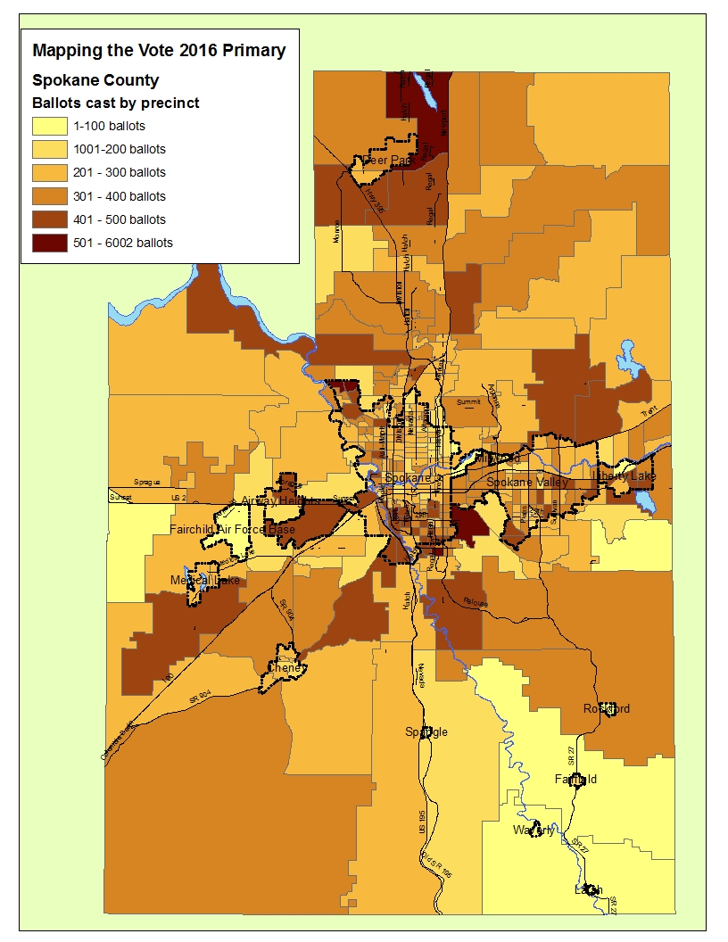
Where the primary votes were in Spokane
The 2016 primary won't go down as a highwater mark for voter participation.
In Spokane County, turnout was about 34 percent, but that's an average which takes in some precincts with much lower turnout as well as those where it was significantly higher.
But turnout doesn't win elections; votes win elections. Some Spokane precincts have only a handful of voters, while others have hundreds, so high turnout in a small precinct isn't as important as moderate turnout in a really big precinct.
So along with a map of precinct, Spin Control mapped the number of votes by each precinct. That map shows that the most votes camde from familiar places -- Spokane's South Hill, some parts of Northwest Spokane city and precincts north of there, the suburban Valley just east of Spokane, and parts of Liberty Lake.
Not so many votes in northeast Spokane, Fairchild Air Force Base and some other parts of the West Plains.
The map above is the vote count, but we have PDF versions of both maps.