Gold Hill great trail for dogs, their humans

Molly was our guide for this hike. We hadn’t scheduled a guide, but she met our group of four, plus Piper, our pound puppy, in the parking lot at the trailhead. She seemed eager to share this adventure and since this was a new hike for us, and maybe because she was a cute little country gal, we followed her lead up the pleasant trail through the brilliant fall colors. Occasionally Molly would turn around and check on our progress, and she maintained a pace which was acceptable to all.
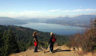
At the top of the 3.7-mile hike, we relaxed near the rock outcroppings. After taking in the view of Lake Pend Oreille, the Selkirk Mountains, the Pend Oreille River, Schweitzer Mountain and the town of Sandpoint, Molly shared a little of the local flora with us by bringing a pine cone for our inspection. Next, turning on the trusty GPS, we found a nice little Geocache, which among other treasures, contained a plastic bag of little glass balls labeled with the words, “Refill pack for people who have lost their marbles.”
After enjoying sunny weather and a break at the top with our friends, we meandered back down the trail, marbles in order and Molly again in the lead. Back at the parking lot, Molly gave us a smile and headed toward Bottle Bay Road, no doubt on another mission. We all concluded the black-and-white border collie lives near the Gold Hill trail and finds her way back and forth on a regular basis to share this great trail with humans.
Access from I-90: Go north on U.S. Highway 95 for approximately 40.3 miles, then turn right on Bottle Bay Road. Then go 4.8 miles to the trailhead on the right.
Length: 3.7 miles (one-way).
Elevation: There is an elevation increase change of approximately 1,200 feet from the parking lot to the trail end, with a maximum elevation of 3,400 feet.
Use: Moderate.
Trail condition: Nicely maintained, hard-packed trail.
Difficulty: Moderate with some steep stretches. Nice hike for the whole family.
Restrictions: Hikers should be extra cautious during the hunting season. Stick to the main train and make enough noise that hunters will know you’re not fair game. Closed to motorized vehicles.
What to see: Wildlife, forests and spectacular views.
Special features: Molly, the black-and-white border collie, might just show up as your guide. Consider bringing treats for her tip. A Geocache is hidden at the top.
Preparation: A free trail guide available at the Sandpoint Ranger District, 1500 Highway 2, Suite 110 Sandpoint, ID 83864-9509. Phone: (208) 263-5111. Web site: www.fs.fed.us/outernet/ipnf. The ranger office suggests leaving your trip schedule with a responsible person. Detailed topographical maps are available for purchase from the following vendors in Coeur d’Alene: Black Sheep Sporting Goods, the Yacht Club Sales and Service and North Idaho Blueprint. Reference “Talache” on the USGS map.
Gear: A safety orange vest or bright clothing is recommended accessories during the hunting season. Good hiking boots or walking shoes are essential. Dressing for changing conditions and carrying drinking water and a first-aid kit are always good ideas.
Note: Geocaches are found in a treasure hunt game, using clues from the Web site, www.geocaching.com.