Whiteout winds close Inland NW roads, schools
More snow likely on Thursday through Saturday with milder temps
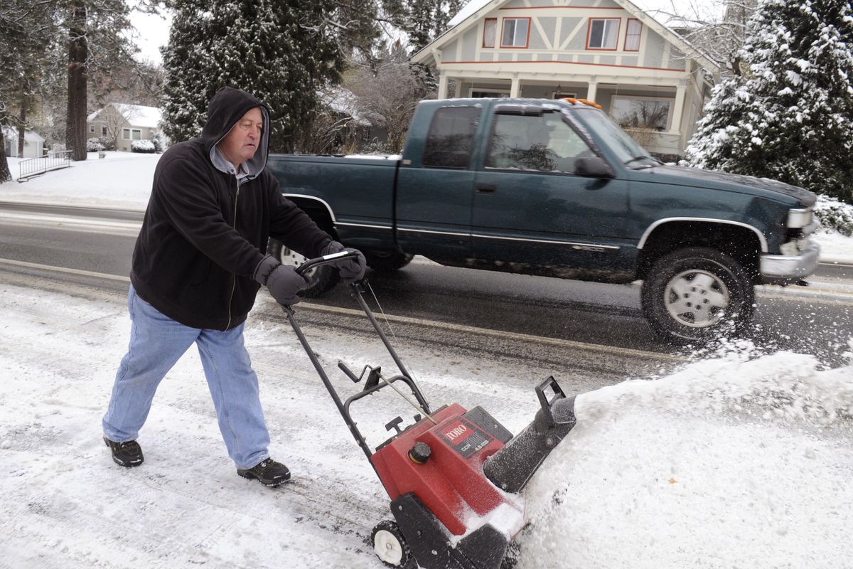
Whiteout conditions prevailed across a broad swath of the Inland Northwest this morning as a major arctic blast and snow storm threatened to bring the region to a standstill.
Blowing snow forced closure of several highways and roads with winds gusting as high as 37 mph in the Ephrata area of the Columbia Basin this morning.
Numerous school districts in the region, including Post Falls, West Bonner, Medical Lake, Moses Lake and the Nine Mile Falls elementary and middle schools, shuttered their doors today as wind chills hit dangerous levels.
The feel of the cold and wind on the skin in Spokane was minus-9 at 7 a.m.
A blizzard warning that began on Monday afternoon was lifted at mid-morning.
Interstate 90 was open and traffic was moving, although clusters of congestion and slow downs were reported. Authorities were responding to accidents across the region involving vehicles that had problems negotiating the snow and ice.
The Washington State Patrol reported that 13 vehicles had slid off I-90 about 40 miles southwest of Spokane after 2 p.m.
Six inches of new snow fell at Spokane International Airport in the 24 hours ending at 4 a.m. with a total of 8 inches on the ground there.
U.S. Highway 195 from Colfax to Idaho state line southeast of Uniontown was reopened to traffic this morning after being closed early this morning from drifting snow.
I-90 mountain passes in Washington and Idaho had compact snow and ice, but were open.
Spokane Transit Authority had switched to a winter contingency route for bus No. 45 on Southeast Boulevard. Otherwise, buses were running on time this afternoon.
“Things are going real smoothly,” said Molly Myers, spokeswoman for STA.
Winter updates by STA are posted on the agency website at spokanetransit.com at 4 p.m., 8 p.m. and 6 a.m. daily.
A number of incoming and departing flights were being delayed this morning and this afternoon at Spokane International Airport, all of them the result of back ups at other airports.
“Operationally, we’re normal,” said Todd Woodard, spokesman for the Spokane airport.
Winds in Spokane and Coeur d’Alene were gusting to 21 mph with one reading in Coeur d’Alene showing a gust at 29 mph and Lewiston had a wind at 30 mph at dawn today. Sandpoint had a peak gust of 47 mph this morning.
In many locations, the blizzard began around nightfall on Monday as a low pressure area migrated along the Oregon border, drawing dense arctic air toward it from the north.
Forecasters said they expect the winds and snow to taper off today with the temperature barely making it to 10 degrees by 2 p.m. It was 14 at Felts Field.
A high of 10 is expected in Spokane Wednesday followed by 20 on Thursday.
Cold temperatures are a sure thing tonight once conditions calm down and skies shed some of their clouds.
Spokane should see partly cloudy skies tonight and a bone-chilling low of minus-10 and Coeur d’Alene is forecast to hit minus-9. Even colder weather is likely in Sandpoint and Bonners Ferry.
Temperatures should moderate on Thanksgiving with highs in the teens in Spokane, but a new snow storm is going to bring additional accumulations with an inch during the day and 2 to 4 inches overnight Thursday in Spokane and Coeur d’Alene.
The new snow continues with up to an inch on Friday before the storm winds down with showers on Saturday and Sunday.
The city of Spokane this morning reported that it had deployed 20 plow trucks and had completed an initial sweep of the city’s arterials and bus routes, but would return for a second pass.
The city declared a stage-1 emergency, which requires vehicle owners not to park on arterials and bus routes during plowing operations. The idea is to get a full-width plowing to prevent snow obstructions. In a release issued Tuesday afternoon, the city said it expected to lift the emergency overnight as plowing continued on arterials and bus routes.
Spokane Valley had eight trucks working since Monday to clear primary arterials first and then move to secondary arterials. Updates are online at spokanevalley.org.
Some of the strongest winds were reported in Grant County where a number of roads and highways were closed, including state Highway 28 that runs from Davenport through Odessa in Lincoln County to Ephrata.
Also, state Highway 23 near Harrington was reopened today after drifting snow and whiteout conditions.
Portions of state Highway 21 from Lind to Wilbur were closed Monday night and reopened about 3:45 p.m. Tuesday.
State Highway 231 near Sprague in Lincoln County was also closed Monday night.
Visibilities under 35 mph gusts went as low as three-quarters of a mile northwest of Moses Lake.
Sandpoint reported frequent wind gusts to 35 mph on Monday night.
Late Monday, a National Weather Service employee reported that two inches of snow fell in 45 minutes on the South Hill.
Seven inches of heavy snow was reported in Warden in Grant County.
Elsewhere, 12 inches of snow was reported near Moscow; 9 inches fell at Usk in Pend Oreille County, 8.5 inches in St. Maries in Benewah County; and 8.5 inches near Clark Fork in Bonner County.
Forecasters said the region should see a break in the snow until Thanksgiving Day when a 40 percent chance of snow arrives. The risk of snow increases to 60 percent on Thursday night through Friday night and then goes to 50 percent on Saturday. The snow level Saturday is expected to be 2,200 feet as the moderating influence of Pacific air creeps over the region.
Snow risks fall to 30 percent on Sunday.
Temperatures are going to moderate some with highs on Thursday of 21 in Spokane and 19 in Coeur d’Alene and a low Thursday night of 15.
Highs will go to the 30s on Friday and Saturday as the arctic air eases its grip.