CdA river basin project locates lead deposits
Map will help officials remediate hot spots
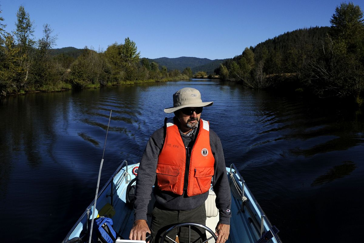
Ed Moreen powered a small motorboat up the Lower Coeur d’Alene River Friday morning, pointing out colorful layers of sediment in the riverbank. The reddish soil was stained by iron oxide, an indicator that other heavy metals were present.
Each year, about 390 tons of lead washes out of the Coeur d’Alene River at Harrison and ends up in Lake Coeur Alene.
“Eighty-five percent of the lead that shows up at Harrison is coming from this riverbed,” said Moreen, a remedial project manager for the U.S. Environmental Protection Agency.
It’s a vexing problem for the EPA, which is charged with cleaning up historic mining pollution in the Coeur d’Alene Basin. When spring floods scour the river bottom, they churn up fine lead particles, transporting them into one of Idaho’s most popular recreational lakes.
A $250,000 mapping project underway this month will help address the problem. An EPA subcontractor is collecting hundreds of sediment samples from the riverbed, which will help agency officials locate where the lead hot spots are and where the river bottom is highly erodible.
With that information, Moreen said, the EPA can begin to design projects targeting the worst pockets of lead, keeping it out of Lake Coeur d’Alene.
Most of the lead flowing into the lake sinks to the bottom, where it doesn’t pose immediate threats to human health, said Jamie Brunner, who works for the Idaho Department of Environmental Quality. People swimming in the lake are at low risk for ingesting harmful levels of lead, she said.
But the volume of lead flushed into the lake each year is enough to fill about 22 dump trucks. Lead, a neurotoxin, does pose risks to fish and other wildlife. And it could become a human health problem if the lake’s chemistry was disrupted and the lead was re-suspended into the lake’s water column. The EPA has grappled for years with how to address heavy metals in the Lower Coeur d’Alene River, which encompasses 37 scenic river miles from Enaville to Harrison.
Before modern pollution control laws took effect, upstream mining companies dumped their waste products into the river. Over decades, the tailings settled out in this slow-moving stretch of river and its floodplain. Every spring, migrating tundra swans die from ingesting harmful levels of lead in marshes along the river.
Core sampling indicates that the pollution is layered 4 to 5 feet deep in the riverbed. Some sediment samples had lead concentrations of 60,000 parts per million. That’s high, Moreen said. Samples from the pre-mining era have lead levels of 50 to 70 parts per million.
The sampling is now in its second year. This year’s collection effort will reveal vital information about the riverbed’s physical characteristics, including where flooding leaves scour holes, said Kim Prestbo, an EPA remedial project manager.
That data will be used in developing models for pilot cleanup projects, which could begin within two years.
The mapping work is being paid for out of a $263 million settlement with Hecla Mining Co.
Hecla, which owns Idaho’s oldest operating silver mine, agreed to the settlement two years ago for its contribution to historic mining pollution in the Coeur d’Alene Basin.