Overnight snow affects roads, closes Snoqualmie Pass as what could be the lowest temperature of cold snap approaches

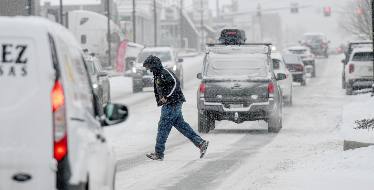
Snow blanketed Spokane overnight, leaving roads icy ahead of more snow that fell Thursday afternoon.
The storm that blew into Spokane brought more than 2.2 inches of snow to Spokane International Airport between midnight Thursday and 4 p.m., said Laurie Nisbet, meteorologist at the National Weather Service Spokane.
More snow fell in some parts of Spokane, such as the South Hill, she said. The heaviest snowfall tapered off into lingering flurries Thursday evening.
Snoqualmie Pass was closed in both directions early Thursday morning after more than 9 inches of snow, and it didn’t reopen until 1 p.m. Power was out at the summit and there was near zero visibility, according to the Washington State Department of Transportation.
“It’s snowing hard,” Nisbet said. “An inch or more an hour.”
The pass was closed again in both directions around 4 p.m. after an SUV crashed into a tanker carrying sulfuric acid on Interstate 90 near Cle Elum, the DOT tweeted Thursday evening. The SUV under the tanker truck was within a half-inch of hitting the drain valve, WSDOT tweeted. The vehicle was removed by letting air out of the front tires with DOE on site to monitor, WSDOT said. The pass reopened about 7 p.m.
Stevens Pass was open Thursday evening, but conditions were difficult with compact snow and ice on the roadway, according to the state transportation website.
Near the I-90 and U.S. Highway 2 interchange in Spokane, a crash involving a semitruck and Chevy Volt left the truck jackknifed and fully blocked the interstate at about 8 a.m.
The cause of the crash was speed too fast for conditions, Washington State Patrol Sgt. Greg Riddell said in a video posted on Twitter. The driver of the car sustained injuries that weren’t life-threatening, Riddell said. The road reopened at about 11:30 a.m.
WSP said the truck driver, Semen V. Ivanov, of University Place, Washington, was attempting to pass the Chevy when he lost control. He was cited for negligent driving.
The city of Spokane urged people to drive according to road conditions in posts on social media. Crews will be out working 24 hours a day until every street in the city has been plowed, according to a news release from the Public Works and Utilities Department.
Plowing the entire city usually takes about three days, starting with arterials before moving to side streets.
Vehicles should be parked on the odd-numbered side of the street in residential areas, the department said. Residents are asked to clear snow off parked cars to allow plow drivers to see them better.
Residents and businesses are asked to clear a 36-inch pedestrian path on sidewalks. Residents who are unable to do so can call 311 to connect with resources for snow removal.
Multiple flights into Spokane International Airport were canceled Thursday morning, though some of those were believed to have been called off from staffing shortages related to the omicron coronavirus variant and not the weather. Five flights from Seattle to Spokane and six flights from Spokane to Seattle on Delta, Alaska and American Airlines were among those canceled, according to the airport’s website. A slew of flights was delayed.
Nationwide there have been more than 8,600 flights delayed and more than 2,600 cancellations, according to FlightAware.
A second wave of snow fell across the state Thursday afternoon, Nisbet said. The storm was expected to bring another 1.5 inches of snow to the Spokane area, maybe more depending on if the center of the storm moves north or south.
“It’s really variant on that,” Nisbet said of the amount of snow people may see. “As you head south, you will see more snow for sure.”
A winter storm warning was issued for the 24-hour period from 4 a.m. Thursday to 4 a.m. Friday for much of the Palouse. Heavy snow was expected around Tekoa, Rosalia, Pullman, Uniontown, Moscow and Potlatch, according to the weather service advisory.
By Thursday evening, the weather should dry out but won’t warm up, Nisbet said. The low temperature overnight is forecast to be 3 degrees. Saturday likely will be colder with a forecast low of 6 below zero.
“The reading on Saturday could be the coldest we’ve seen yet with this cold outbreak,” Nisbet said.
The coldest reading so far in the cold snap was 4 degrees on Tuesday morning, she said.
“After this round of snow today, it doesn’t look like we have snow in the forecast again until Sunday evening into Monday,” Nisbet said.
For those traveling this week, going east toward Montana likely will have decent road conditions with light snow Saturday and Sunday but little accumulation, Nisbet said. Traveling to or from the West Side of Washington likely will be difficult all week, but Nisbet said Saturday will likely be a better day to travel than Sunday.
Greg Mason contributed to this report.