Science behind the storm: A low pressure center took a ‘very favorable track’ to create a lot of wind

Local meteorologists tracked Wednesday’s storm system on its way to the Spokane area during the past week.
Earlier on, forecasters were monitoring a potentially significant rainstorm with possible high winds, said Greg Koch, a forecaster for the National Weather Service office in Spokane. That developed within the past four days, Koch said, as forecasters were able to better determine the chance for significantly strong winds as the storm moved closer.
“We refer to these systems as atmospheric rivers,” Koch said. “Some folks have used the term ‘Pineapple Express’ where you have a strong subtropical plume of moisture directed into the Pacific Northwest.”
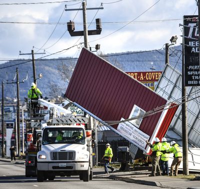
As a result of the storm, a Spokane woman was killed while tens of thousands in the area lost power amid reports of flooded areas, uprooted trees and downed power lines.
In Western Washington, as much as 6 inches of rain was recorded in the Seattle area – depending on elevation – during a 48-hour period as well as gusts between 49 mph (Seattle) and 62 mph (Humptulips), according to the National Weather Service Seattle office. To the south, 68 mph winds were recorded in Pendleton, Oregon, with 70-76 mph gusts observed near Walla Walla, Goldendale and West Richland, according to the weather service.
Meanwhile, parts of Western Montana saw between ½ to 3 inches of rain. Lower elevations recorded 50-60 mph winds, while gusts at higher elevations were recorded at more than 100 mph, said Alex Lukinbeal, meteorologist at the National Weather Service in Missoula. That includes Mount Sentinel, where the city’s noted “M” is located, where an unofficial wind gust of 125 mph was recorded by a private weather station, Lukinbeal said.
Lukinbeal characterized Wednesday’s wind system as a one-in-30-year event.
“It’s the highest wind gust we’ve seen in our office from that weather station,” he said.
In general, wind is caused by the difference of air pressure in a particular area. The greater the difference, the stronger the wind.
In this case, a low pressure center took a “very favorable track” across southern British Columbia to create a lot of wind in the Spokane and Coeur d’Alene area, Koch said.
“As this storm system continues to work across northern plains, it will likely weaken and lose some of its punch,” he said. “These systems will oftentimes cross the continental divide. As they do, they will strengthen as they pull away from the mountains and the friction that impedes these storm systems. Cyclones or areas of low pressure will typically wind up and wind into themselves, and gradually decay.”
By Wednesday afternoon, the National Weather Service had high wind warnings issued to parts of Washington, Idaho, Montana, North Dakota, South Dakota, Wyoming, Nebraska, Colorado, Kansas, Iowa and Minnesota.
The National Weather Service classifies “high winds” as those that exceed 58 mph, Koch said. While the Spokane area experiences several wind events in the 40-50 mph range, Koch said Wednesday’s was more comparable – though shorter and less damaging – to the storm that slammed the area in November 2015.
“While this storm today is very significant, I’m not sure we can classify it quite yet in terms of how often it occurs,” he said. “We’ll need to gather some more information on that.”