DNR updates public land quad maps
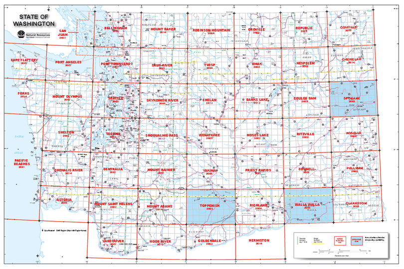
NAVIGATION -- Three updated maps detailing roads, property boundaries, trails, recreation sites, and other information about public lands have been published by the Washington Department of Natural Resources. Names of the maps and the areas they cover are Chewelah, Mount Baker and Mount Adams.
Washington state public lands quadrangle maps are popular with hunters, backcountry hikers and others who use public lands for outdoor recreation. The maps also are used by emergency responders.
Each full-color printed map shows the landscape in a 1:100,000 scale (1 inch equals approximately 1.6 miles) and covers an area of about 1,600 square miles. Featuring shaded relief to indicate terrain, the 26” x 37” maps show highways, roads, trails, water features, wildlife areas, and other key features.
Outdoor recreation enthusiasts can use the maps to locate public lands managed by DNR, Washington Department of Fish and Wildlife (WDFW), and the State Parks and Recreation Commission, as well as lands managed by federal and other public agencies.
The public lands quadrangle maps are part of a series of 50 maps that DNR publishes. The maps are available for $9 each, plus sales tax, for Washington state residents.
The maps can be purchased online.
